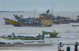
The storm surge is expected to be 1-2 metres above astronomical tide is very likely to inundate low lying areas of Mumbai, Thane and Raigad districts and 0.5-1 metre height above the astronomical tide likely to inundate low lying areas of Ratnagiri district during the time of landfall.
The depression over east-central Arabian Sea is likely to intensify into the cyclonic storm Nisarga, which will make landfall very close to Alibag, 94 km south of Mumbai, on the afternoon of June 3.
Nisarga is expected to have a wind speed of 100 kmph to 110 kmph, with gusts of up to 120 kmph.
“The landfall location will be very close to Alibag but extensive damage can be expected in Mumbai also,” said Sunita Devi, in-charge of cyclones at the India Meteorological Department (IMD).
The deep depression is currently located 280 km west-southwest of Panjim (Goa), 490 km south-southwest of Mumbai (Maharashtra) and 710 km south-southwest of Surat (Gujarat).
The cyclone is likely to cross the north Maharashtra and adjoining south Gujarat coast between Harihareshwar (Maharashtra) and Daman during the afternoon of June 3.
The storm surge is expected to be one to two metres above the astronomical tide and is very likely to inundate low-lying areas of Mumbai, Thane and Raigad districts at the time of landfall. It is also expected to be about 0.5 to one metre above the astronomical tide and likely to inundate low-lying areas of Ratnagiri district.
Extremely heavy (more than 20 cm) rains are expected in parts of Mumbai, Thane, Raigad, Sindhudurg and Palghar.
“Cyclone Nisarga is about to scrape around Mumbai on 3rd June. If that happens, it will be the first-ever cyclone in recorded history to hit the Maharashtra coast in June. Will it bring in floods too?...IMD has forecast a moderate cyclone strengthening up to 100 kmph. It’s not just the direct impact of the winds that we need to worry (about). Forecasts indicate heavy rains up to 200 mm, and INCOIS has forecast storm surges with waves of 3–6 meters as Nisarga approaches landfall,” tweeted Mathew Roxy Koll, climate scientist at the Indian Institute of Tropical Meteorology.
He added, “If this happens over Mumbai during the high tide time on 3rd June morning—the rains and storm surge and the tide can work together to flood a city that is already clogged. All these events overlap as a ‘compound event’ on a rising sea level in the background.”


Comments (0)